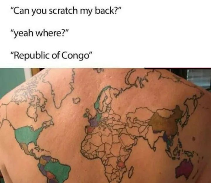
Republic of Congo or Democratic Republic of Congo?
Funny: Home of the Haha
Welcome to /c/funny, a place for all your humorous and amusing content.
Looking for mods! Send an application to Stamets!
Our Rules:
-
Keep it civil. We're all people here. Be respectful to one another.
-
No sexism, racism, homophobia, transphobia or any other flavor of bigotry. I should not need to explain this one.
-
Try not to repost anything posted within the past month. Beyond that, go for it. Not everyone is on every site all the time.
Other Communities:
-
/c/[email protected] - Star Trek chat, memes and shitposts
-
/c/[email protected] - General memes
Having that tattoo 100 years ago and over decades must have sucked...
Yeah, it's me again, please remove the border and re-color Poland, Austria, ...
Nevermind, German lost, change the color back and add borders...
I'm guessing the person with this tattoo gets them colored in once they've visited that country, which if so I think that's pretty cool
It’s already out of date because it’s missing the 2011 border between Sudan and South Sudan.
The map is also kind of a blobby mess in the Middle East, with a few countries missing, and they forgot the border between Algeria and Mauritania.
Projecting a Mercator projection onto a curved surface... Greenland doesn't deserve that kind of treatment.
At least the map includes New Zealand
You think the treatment of GREENLAND is bad? See if you can find the tiny spike that the peninsula and hundreds of islands that is Denmark has been reduced to on this 😄
Greenland is the most obvious (to my eye) case of the distortion that Mercator projection causes at near-polar latitudes.
I'm not anywhere near as confident that I could say what shape Denmark is at the best of times.
That's completely fair 😁
I could say what shape Denmark is
Middle finger.
The Netherlands is not more than a squiggly line here, looks like we need to claim some more sea.
And yet they appear to have omitted Zealand.
Downunder 😏
As soon as I saw the map, I thought how countries are not represented on a real size basis in the world map. A quick Internet search brought me to truesizeofcountries , a very cool project for anyone interested.
I love it.
Antarctic drilling is legal again
Just don't have an American girlfriend
“Places I’ve been”
Colors in America, but not Alaska.
Probably counting only the contiguous 48
(Proceeds to scratches his Ass)
I thought you were a Geography Major?
(whispers sensually in his ear) I am.
That a fucking dope tattoo
Where's South Sudan?
To the south of Sudan, actually.
Luckily, he hasn't gotten Sudan colored in yet so there's still time to draw the new border.
But that's the problem with a tattoo like this: imagine having to get a cover-up because some inconsiderate separatist jerks won their "freedom and right of self-determination," SMH!
They might've got the tattoo before South Sudan split from Sudan.
Lol I wanna see on a dudes big fat hard belly. You know the type. None of that floppy belly shit.
Germany and Denmark are totally messed up. Terrible, just terrible.
Do you mean the Democratic Republic of Congo or Congo?
Also, fuck the mercator projection
