this post was submitted on 15 Jan 2025
201 points (95.1% liked)
Map Enthusiasts
3714 readers
7 users here now
For the map enthused!
Rules:
-
post relevant content: interesting, informative, and/or pretty maps
-
be nice
founded 2 years ago
MODERATORS
you are viewing a single comment's thread
view the rest of the comments
view the rest of the comments
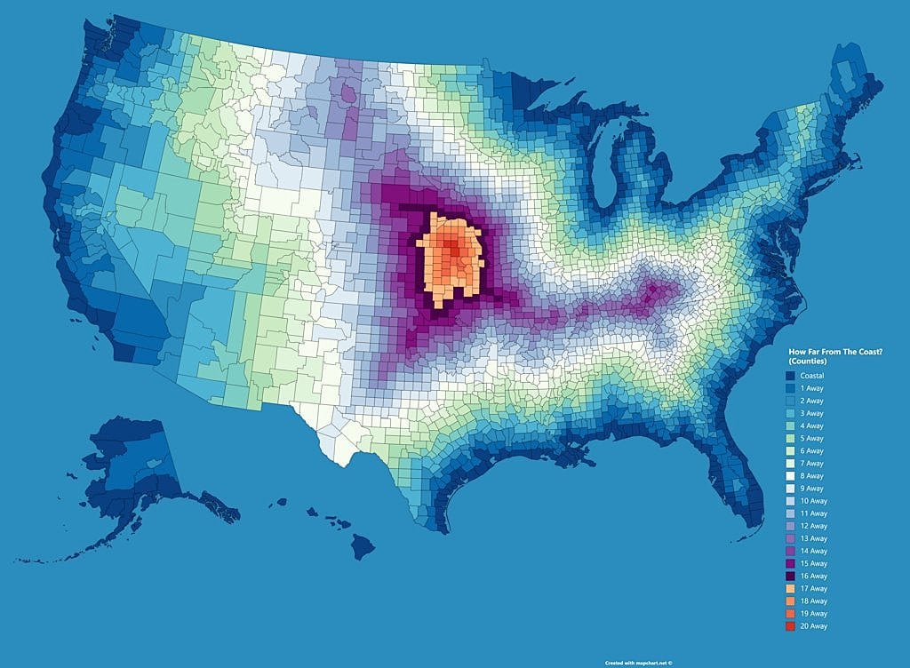
"A" coast. This also makes a distinction between the Great Lakes and... every other lake in the US. It's not salt water, because, well, the Great Lakes. So what determined whether a lake was big enough to qualify as having "a shore"? The Great Salt Lake in Utah is the 7th largest lake in the US (3 down from Lake Ontario, which is represented) and doesn't appear to be be considered.
Are these "shores as US national borders, except for the shores of rivers?"
The great salt lake doesn't connect to the ocean or any other shore and therefore is not a major shipping route. Also it may only be two more down than Ontario but it's an order of magnitude smaller.
So, the definition is "a body of water from which one can navigate - even if by river or canal - to an ocean"? How big does the traversal have to be - if I can get there by canoe without portage, does that count? What about Lake Eirie? AFAIK, you can't navigate without portage from Eirie to the Atlantic, but it connects to Lake Ontario via the Niagara River.
The map doesn't count the Mississippi river, it's not about ship navigation.
It's a bad map, but it makes sense and calling the great lakes a coast isn't that weird.
Any arguments to have to follow up are pointless and will fall on deaf ears, I don't really care about your protests.
Okay. I don't think it's a bad map; I think it would have helped to define what counts as "a coast," is all.