8
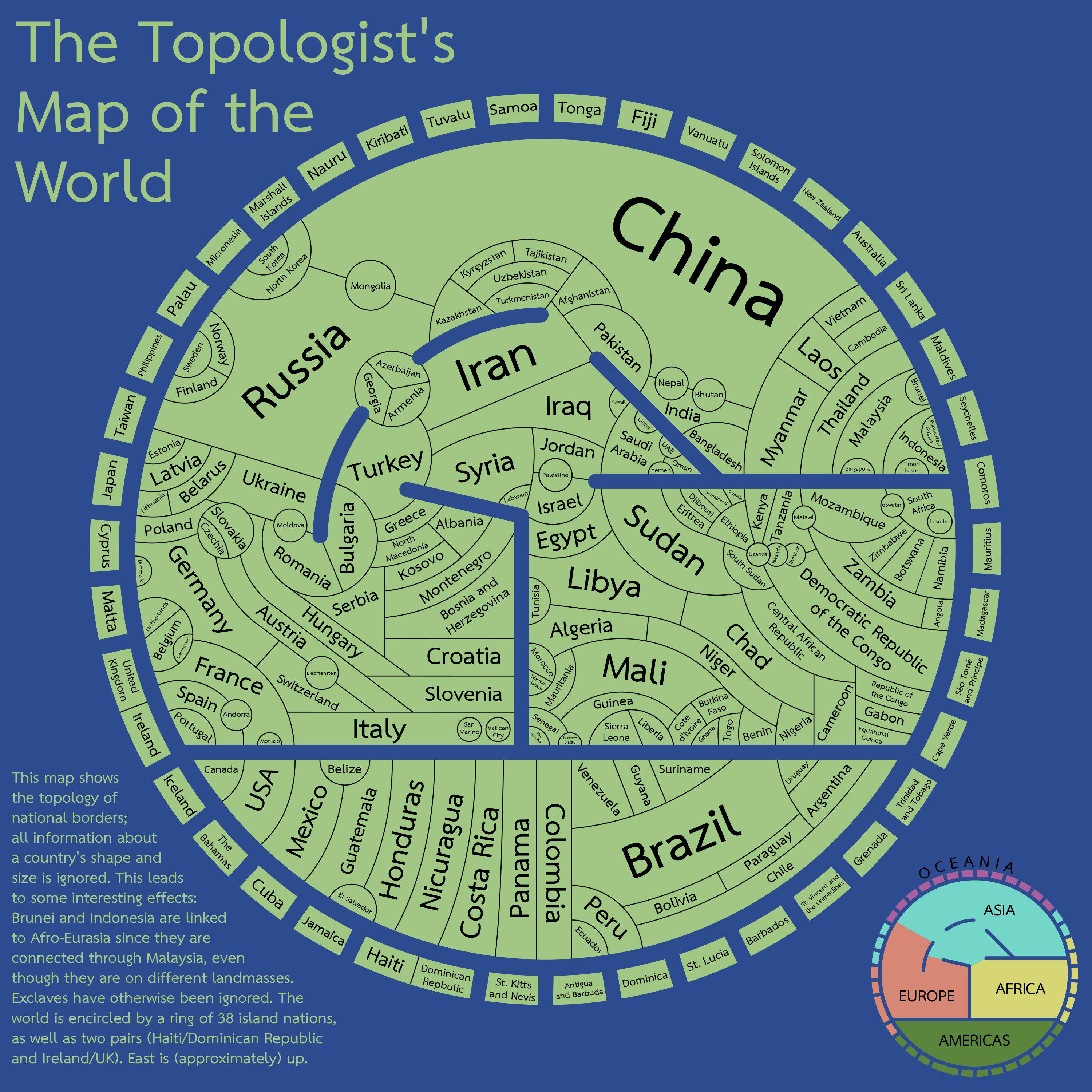
The topologist's map of the world - a map showing international borders, and nothing else
(files.catbox.moe)
For the map enthused!
Rules:
post relevant content: interesting, informative, and/or pretty maps
be nice
It made me think about that "maps only need 4 colors" (I don't remember the proper name, but it's an idea that maps with political borders can paint every state/country/whatever using 4 different colors and you'll never get the same color bordering another), seems like the perfect opportunity to see if it applies here
Here's a way to do it https://i.imgur.com/YULx0sg.jpeg
East Africa and the Balkans took a little bit of figuring out
Edit: and sure enough, there's actually a mistake in East Africa. DR Congo and Tanzania shouldn't be the same colour. I think it can be fixed with the following changes:
It's the Four Color Theorem.
And well, it's actually mathematically proven, but not for maps with disjointed regions that need to be colored the same, such as Alaska + mainland USA.
(In that particular case, it's not too difficult to resolve, but you don't get a guarantee for it.)
The map in the post actually merges such disjointed regions, though, so it absolutely should work there.