this post was submitted on 19 Jun 2024
13 points (93.3% liked)
Map Enthusiasts
3432 readers
3 users here now
For the map enthused!
Rules:
-
post relevant content: interesting, informative, and/or pretty maps
-
be nice
founded 2 years ago
MODERATORS
you are viewing a single comment's thread
view the rest of the comments
view the rest of the comments


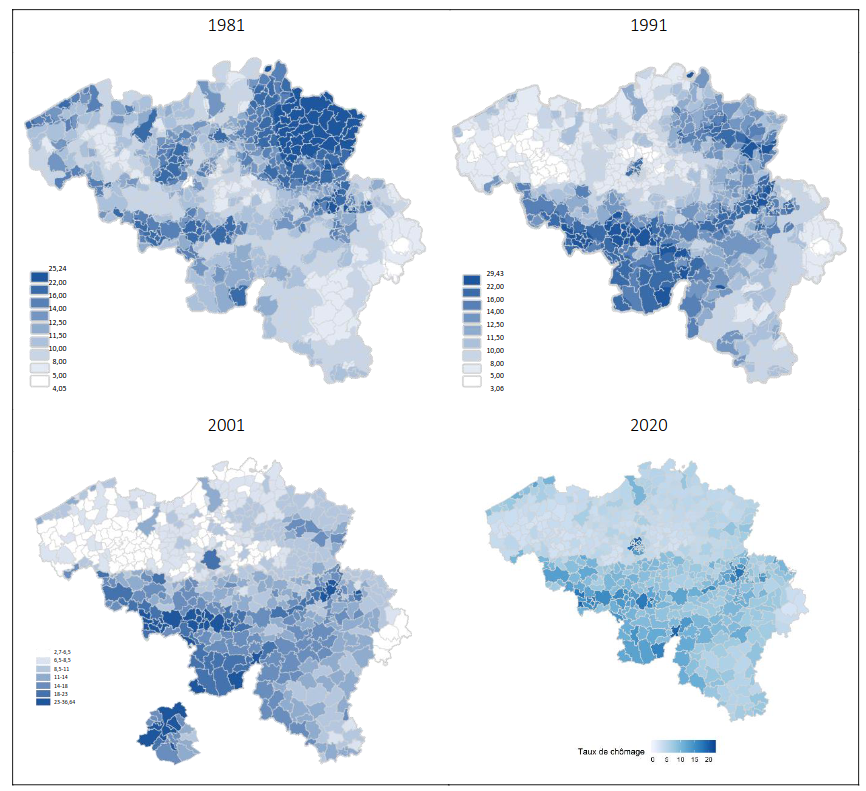
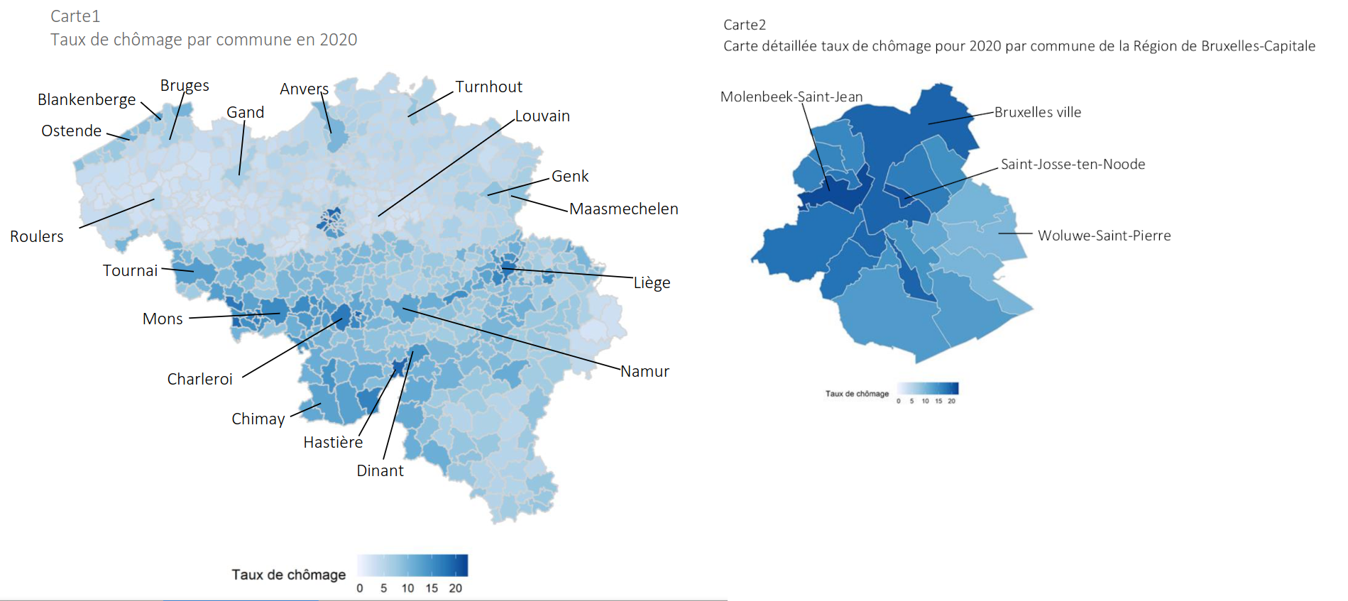
I see some sort of “unemployment belt” in from Mons through Liège, I wonder what caused that?
The area used be be a huge industrial area, which then suffered from desindustrialisation
You have similar areas in the north/east of France