this post was submitted on 27 Nov 2023
914 points (98.7% liked)
Funny: Home of the Haha
5745 readers
706 users here now
Welcome to /c/funny, a place for all your humorous and amusing content.
Looking for mods! Send an application to Stamets!
Our Rules:
-
Keep it civil. We're all people here. Be respectful to one another.
-
No sexism, racism, homophobia, transphobia or any other flavor of bigotry. I should not need to explain this one.
-
Try not to repost anything posted within the past month. Beyond that, go for it. Not everyone is on every site all the time.
Other Communities:
-
/c/[email protected] - Star Trek chat, memes and shitposts
-
/c/[email protected] - General memes
founded 1 year ago
MODERATORS
you are viewing a single comment's thread
view the rest of the comments
view the rest of the comments

What Greenland actually looks like is always wild.
It looks like this massive arrow head that stretches so far to the east and west as you go north...
When really it's just like a normal island.
Still pretty big though, about the same north-south as the u.s.
I mean it is a big island.
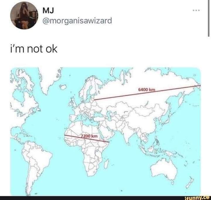
But on the standard map it looks like it's as big as Mexico, Canada, and USA combined.
When really it's only about 30% larger than Alaska by square km.
You undersell Alaskas sheer square milage, it is a chunky boy
Alaska is 1.7 m sq km and greenland is 2.2 m sq km. So I don't think I'm too far off.
So greenland is a bit bigger, when it's crazy on the map they don't look at all to be on the same scale.
It's even crazier for Mexico. Mexico is only a little bit smaller, but on the map it looks abysmally small in comparison.
My point is Alaska is 1/5 of the USA's landmass. Calling Greenland a big island is underselling. If it were on its own in the Atlantic or pacific we'd argue over if it count as a dwarf continent
I'm not saying it's not a massive island.
But just on standard maps it looks like it's the size of Mexico, Canada, and US put together.
When it's just a bit bigger than Mexico.